Viral Aerial Flood Image of Chachoengsao Proven to be AI-Generated
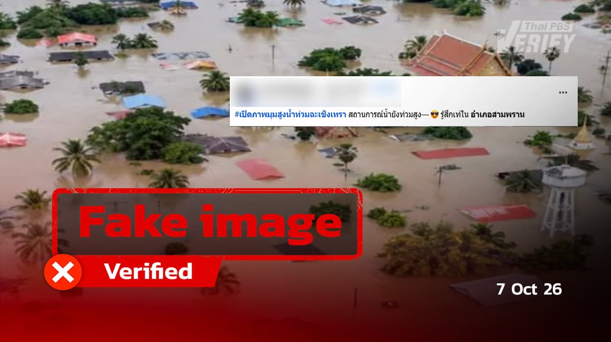
Thai PBS Verify has traced the source of the fake image to Facebook.
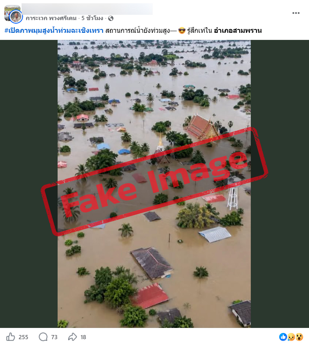
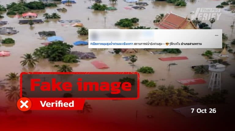
A Facebook post featuring a flood image came with the caption: ‘Revealing an aerial view of the Chachoengsao floods. High water levels persist. Feeling cool in Sam Phran District.’
An investigation by Thai PBS Verify detected a Facebook post containing a flood image and the caption: ‘Opening an aerial view of the Chachoengsao floods. Water levels remain high. Feeling cool in Sam Phran District.’
The post received 255 expressions of reaction, generated 73 comments, and was distributed through shares on over 18 occasions.
Is the aforementioned flood image an authentic representation of flooding in Chachoengsao?
Upon visual inspection, several suspicious elements were found in the image as follows:
- Almost all the coconut trees look almost identical in shape and leaves, which is a giveaway that the image was made or copied by AI.
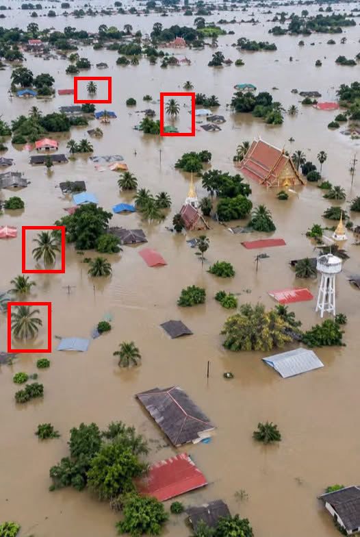
2. The temple depicted in the image does not conform to general architectural layouts, as temples typically feature a crematorium (meru), with the exception of certain types such as royal temples, which may not have one.
The image was subsequently subjected to AI detection tools by Thai PBS Verify, including DeepAI, WeDetect, Sightengine, and Image Detector, all of which confirmed a high likelihood of AI creation.
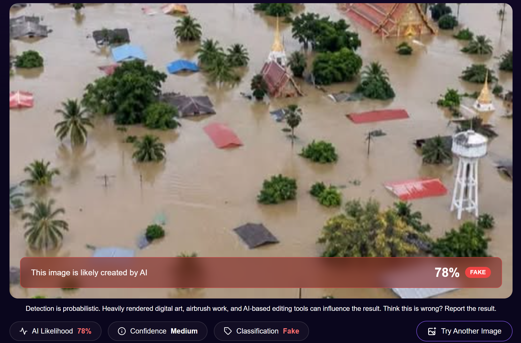
Verification results provided by the DeepAI website
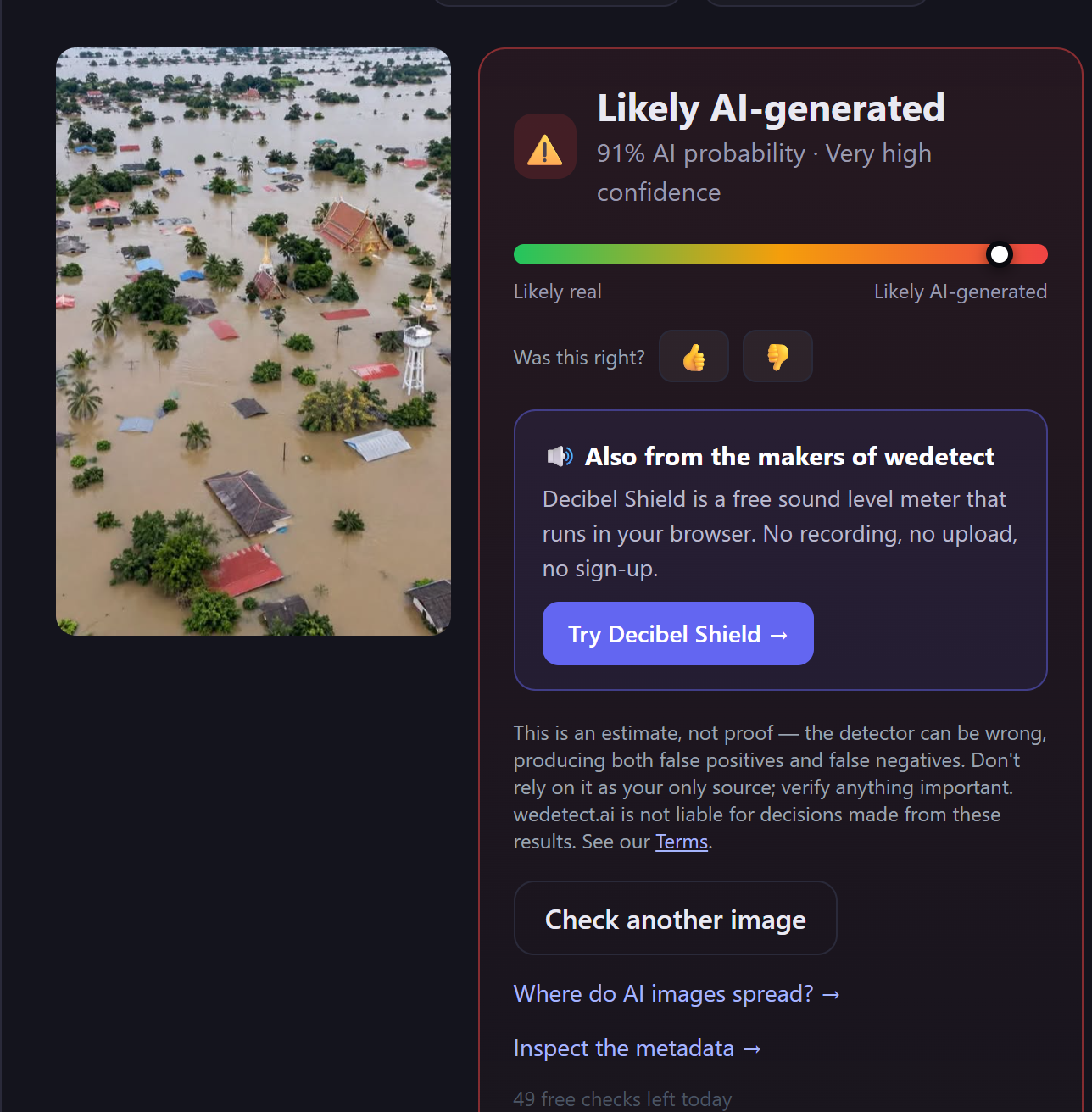
Verification results provided by the WeDetect website
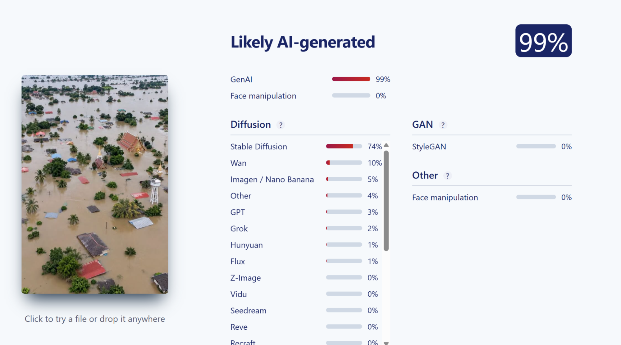
Verification results provided by the Sightengine website
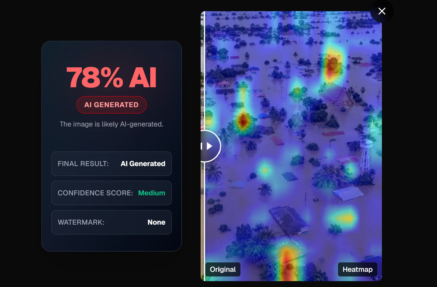
Verification results provided by the Image Detector website
Thai PBS Verify consulted Mr. Sathaporn Patanakuhar, Founder and Chief Executive Officer (CEO) of Guardian AI, for an expert analysis of the photograph. The analysis concluded that the image bears characteristics indicative of artificial intelligence generation. Key observations include the uniform height of the dwellings, consistent flood levels reaching near roof height, structural inconsistencies in the relative placement of houses and the temple compared to actual terrain, and the absence of discernible connecting roadways.

Mr. Sathaporn Patanakuhar, Founder and Chief Executive Officer of Guardian AI
What is the status of the flood conditions in Chachoengsao Province?
On October 6, 2026, the flooding in Chachoengsao Province continued to impact local residents, particularly causing widespread damage to the agricultural sector. Some farmers expressed concern that if the floodwaters recede slowly, mango trees could die off and have to be cut down, forcing them to replant and wait several years for new yields.
Mango farmers in Bang Khla District, Chachoengsao Province, are forced to navigate floodwaters to harvest and sell their produce. Notwithstanding high water levels and operational hazards, this action is necessary to secure income, given that the orchards have been inundated for over ten days. Further delay would result in crop spoilage and render the harvest unmarketable.
Cultivators note that mango trees typically endure waterlogging for 10 to 15 days. With flood conditions entering their 10th day, prolonged stagnation through the end of the week could lead to tree mortality, necessitating the removal of existing crops and a 4-to-5-year regeneration period for renewed productivity.
In addition to Chachoengsao’s GI-certified mangoes, agricultural and aquaculture sectors, including rice fields and shrimp ponds, have been severely affected by flooding. A shrimp cultivator reported that millions of baht in capital were ruined following the flooding of the ponds on September 25. Consequently, the shrimp destined for market suffered fatal shock and were washed away by flood currents, as access to the site for mitigation was rendered impossible.
What is the actual truth?
An image circulated as an aerial photograph of flooding in Chachoengsao has been debunked by Thai PBS Verify as AI-generated. Suspicious details—such as identical coconut trees, unrealistic placement of houses and a temple, and a lack of proper roads—did not align with actual geography. Results from various AI detection tools also strongly pointed toward artificial creation.
Even though Chachoengsao Province is confronting genuine flood conditions, notably impacting agricultural zones in Bang Khla District, the disseminated photograph fails to accurately reflect the authentic situation on the ground as alleged. Consequently, this constitutes the utilization of artificial intelligence-generated imagery in conjunction with real event reporting, which risks misleading recipients regarding the flood crisis in Chachoengsao.
Verification Process
- Visual inspection: Upon close observation, almost all the coconut trees in the image share identical shapes and leaf patterns, which strongly suggests that the photo was generated or duplicated using AI. Additionally, the temple’s architectural elements do not conform to standard temple layouts, as it lacks a crematorium for funeral rites.
- Sightengine และ Image detector Inspection via AI Detection Instruments: The image was subjected to verification through multiple AI detection tools, including DeepAI, WeDetect, Sightengine, and Image Detector, all of which pointed to a high likelihood of artificial generation.
- Expert analysis: Thai PBS Verify asked Mr. Sathaporn Patanakuhar, Founder and CEO of Guardian AI, to analyze the photo. He confirmed it looks AI-generated, pointing out red flags like houses that are all the same height, floodwaters sitting at the exact same level near the roofs, a weird layout between the houses and the temple that doesn’t match real geography, and no clear connecting roads.
The Impact of This Misinformation
- Misinforms citizens about the ongoing floods in Chachoengsao.
- Risks triggering public alarm through images that exaggerate the severity of the disaster.
- Leads to inaccurate understanding of spatial conditions and flood intensity levels.
- Can overshadow authentic crisis reports, negatively impacting local communities and farming.
- Diminishes public trust in flood-related news and official warning systems.
What to do with this misinformation?
- Always verify the source of photos and information before trusting or sharing.
- Check the date, time, and location of disaster-related images to ensure they reflect current events.
- Employ photo verification tools or reverse image search to check if an image is repurposed from another incident or created by AI.
- Compare information against updates from official agencies and trusted news outlets.
- Avoid sharing misinformation or AI-generated images to prevent confusion about ground realities.
- Ensure proper sourcing and rely on up-to-date data from authorized bodies when publishing flood reports.